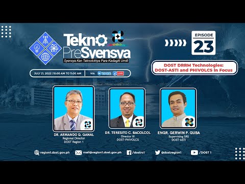
Tekno Episode 23 featuring DOST DRRM Technologies: DOST-ASTI and PHILVOCS in Focus

Okay, so Fivox is currently monitoring 10 active volcanoes through our integrated real time monitoring system. Um this is a typical set possible changes in sea level. This is for ah tsunami monitoring and wiring purposes. And again makigita niyan mga ah tsunami alerting station samin. Ah sa region one dito sa figure. As well as the ah
location of the ah sea level monitor station. Next slide. Okay so we also so for our right now we have around 300 want. And this one would provide the latest status of the Philippine active ah volcanoes monitored by ah by Vivox. And ah inside the mobile
application, users can access the volcano bulletins. We also have the observation summary. As well as the ah location of course and the recommendations on appropriate actions as well as ah reminders for possible hazards that can occur. Again
this is accessible via ah ah airport. And by just one click, makigita niyo kung ano yung mga hazards associated ah, ah, with, ah, that may affect the local ah, International Airport. So, for example, it's prone to ground shaking. Um, it's ah, highly susceptible to liquefaction and it's prone to tsunami. And, for, hydro
meteorological hazards, it's, highly the water floods. But it's safe for storm surge. So it's just one, in one click, Mukigitan yung kada yung mga hazards. That may affect ah ah our critical facilities. So again this is for free. You can get the information because the information ah ah embedded in this hazard hunter comes from Next slide, accompanying the hazard hunter are the two mobile apps. We have the Geo
Mapper PH and the JM Analytics. Um JM PH would allow you to ah ah would allow users rather to ah collect information during field surveys and then integrate the information into the JRS ah PH systems. Ah for the geoanalytics geo analytics does not require technical background to perform fairs on the data. It summarizes hazard and risk assessments that may Uh Liquifaction map of Vigan and pwede mong iflat yung mga schools. Ano yung mga schools that may be affected by leafletion. So ng hazard. Gusumo. You can also plot ah
tsunami and then it will give you all the ah critical facilities ah for example melaton twelve questions and then you just have to answer those 12 questions and the result verify whether your house is properly built and followed appropriate constructive procedures. and recommended measures or it will require necessary strengthening. So you just have the there are twelve questions and then you just have to answer it and then ay malaman mo kung sage ba yung bahay mo or hindi. Next we also have ah three box maps of course. So we, how do, how do we know the hazards in your area? So, the first thing, is to look at the hazard maps. So, all of these are available. Uh, you can
download we have the ah geologic maps from Bureau ah from MGB. We also have the ah peak ground acceleration map from three votes. We have the ah ah velocity 30 model map. And ah the ah ah microsulation maps. Again these maps are ah being used by the by engineers. Um in where they construct their buildings or facilities. Okay
so these maps would provide information collectively to understand the characteristics of the soil and rough layers in the area. That may affect ground motion in the event of an earthquake. Okay next slide. Then Vivox also provides different educational materials to schools and other sectors in the society. Okay so ah we provide seminars and games and emphasize three things for ah the the three things for people's preparedness. We have this ah before, during and what to do after an event. Next slide. Okay so again ah we use
ah the technology to reach out to ah as wide audience as possible. So we use ah Facebook and Twitter. So you can follow us on Facebook and namin. So hindi lang ko pala ah
doing may nag mo monitor po ng mga mga malapit ng sumabogdon pong kapomabasok ang Zbox but for our apps like the Hazard again we rely the data coming from our stakeholders Ah to make the information more robust. Ah then we do this by being partners with ah LGUs and other organizations. All right. Thank you sir. So it's a
collaborative effort. Yeah. And then ano pong mga susunod nakbang. Oh inobasion ang ahabangan namin sa Fivox para sa pagpapayting ng DRRM. Okay so yung equipment in Plantsmart. So ano naman it PlantSmart is to ah come up with ah an auto generated ah planning document for a recovery and rehabilitation. So
automatic na you just have to click meron ka ng ah plano for rehabilitation. Second we plan ah plan to incorporate ah the subsurface ah coming from borehole data. So ah makigita natin ng ayong would be ah three dimensional. We see what's on the surface but ah again limit yung budget natin but as much as possible ah gusto sana namin mga ah magensi pa yung mga networks now. Thank you Sir Toto. Ah next two questions po. First so first sir Gerwin. Okay, so
first question Papaliwana rise to distribute 'no? To install yung mga stages natin.
2022-08-06 14:22


